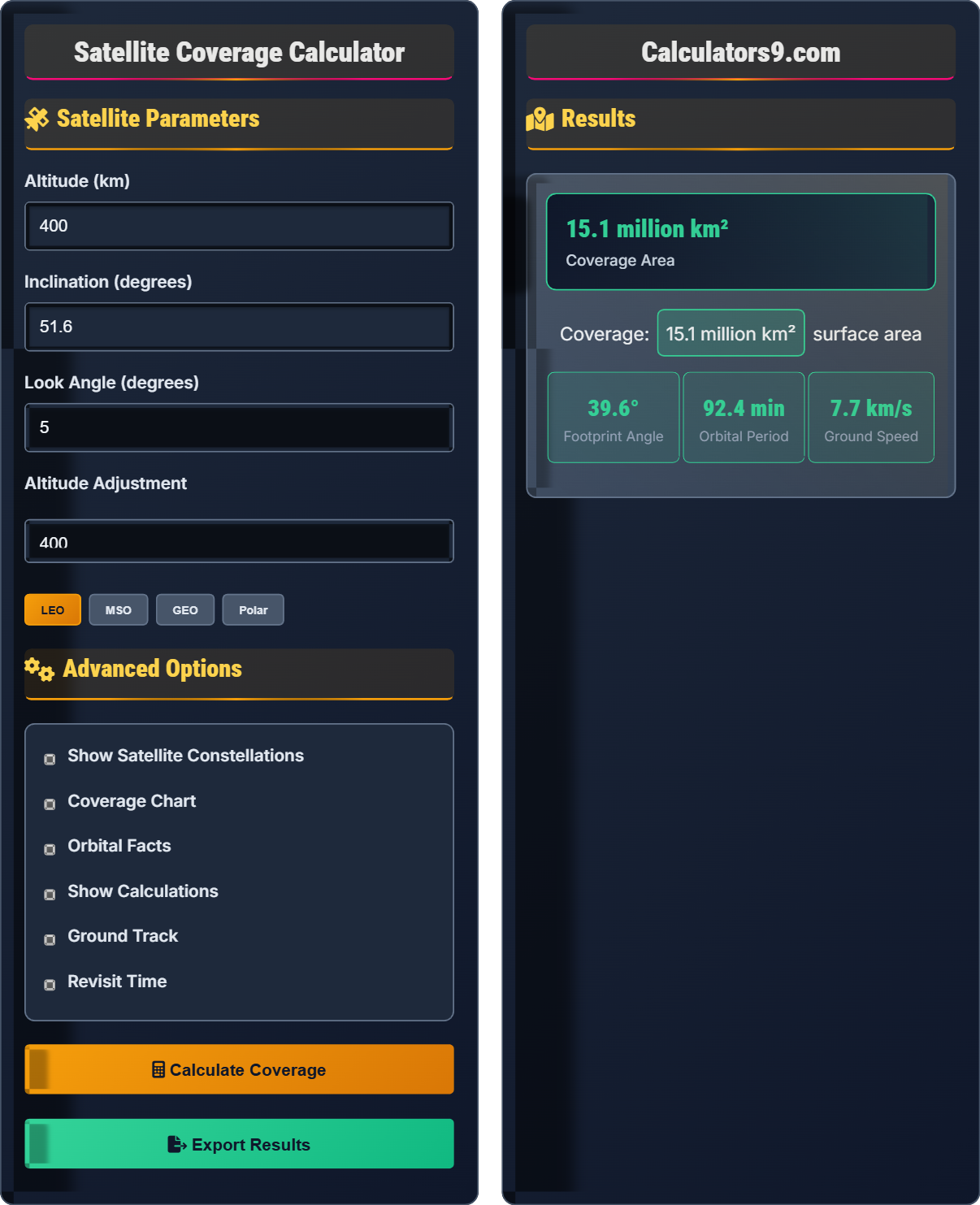
Satellite Coverage Calculator
Orbital footprint • Space engineering tool
Satellite Coverage Formulas:
Show the calculator\( \text{Footprint Angle} = 2 \arccos\left(\frac{R_e}{R_e + h}\right) \)
\( \text{Coverage Area} = 2\pi R_e^2 (1 - \cos(\theta/2)) \)
\( \text{Orbital Period} = 2\pi \sqrt{\frac{(R_e + h)^3}{GM}} \)
Where:
- \( R_e \) = Earth's radius (6,371 km)
- \( h \) = satellite altitude
- \( \theta \) = footprint angle
- \( GM \) = gravitational parameter (3.986×10¹⁴ m³/s²)
These formulas calculate satellite coverage area, orbital period, and footprint angle. The footprint angle determines how much of Earth's surface a satellite can see at once, while the coverage area quantifies the total surface area observable.
Example: For a satellite at 400 km altitude:
Footprint angle = 2×arccos(6371/(6371+400)) = 2×arccos(6371/6771) = 40.6°
Coverage area = 2π×6371²×(1-cos(20.3°)) = 45.1 million km²
Therefore, the satellite covers approximately 45.1 million km² of Earth's surface.
Satellite Parameters
Advanced Options
Results
Satellite Coverage Guide
Satellite coverage is determined by orbital altitude, look angle, and Earth's curvature. The footprint angle represents the maximum angle from nadir that the satellite can observe, while the coverage area quantifies the total surface area visible to the satellite.
Key equations for satellite coverage:
Where θ is the footprint angle, A is the coverage area, Re is Earth's radius, and h is satellite altitude.
| Orbit Type | Altitude (km) | Footprint (°) | Coverage (M km²) | Applications |
|---|---|---|---|---|
| LEO | 200-2000 | ~40° | 45-110 | Earth observation, ISS |
| MSO | 2000-35786 | ~60° | 110-175 | Navigation, weather |
| GEO | 35,786 | ~17.4° | 180 | Communication, weather |
| Polar | 200-1000 | ~40° | 45-80 | Earth mapping, surveillance |
Orbital Mechanics
Maximum angle from satellite to Earth's horizon.
\( A = 2\pi R^2 (1 - \cos(\theta/2)) \)
Surface area covered by satellite.
- Higher altitude = larger coverage area
- Lower altitude = better resolution
- Footprint angle increases with altitude
Space Engineering
Path of satellite's subpoint on Earth's surface.
\( T = 2\pi \sqrt{\frac{(R+h)^3}{GM}} \)
Time to complete one orbit.
- LEO satellites cover small areas frequently
- GEO satellites cover large areas continuously
- Earth's rotation affects ground track
Satellite Coverage Quiz
If a satellite's altitude is doubled, how does its coverage area change?
The answer is C) It increases but by less than double. The coverage area is calculated using A = 2πRe²(1 - cos(θ/2)), where θ is the footprint angle. When altitude increases, the footprint angle increases, but the relationship is not linear. The coverage area increases with altitude, but the rate of increase diminishes as altitude increases, so doubling the altitude results in less than a doubling of coverage area.
The relationship between satellite altitude and coverage area is governed by spherical geometry. As altitude increases, the satellite can see more of Earth's surface, but the rate of increase in coverage area decreases due to Earth's curvature. This is why the relationship is not linear, and doubling altitude results in less than double the coverage area.
Coverage Area: Surface area on Earth visible to satellite
Footprint Angle: Maximum angle from nadir to Earth's horizon
Spherical Geometry: Geometry on curved surfaces
• Coverage area increases with altitude
• Relationship is non-linear
• Rate of increase diminishes with altitude
• Remember: Coverage increases but at decreasing rate
• Higher altitudes = larger coverage but lower resolution
• Thinking coverage area increases linearly with altitude
• Forgetting the effect of Earth's curvature
A satellite orbits at 800 km altitude. Calculate the footprint angle and coverage area. Use Re = 6,371 km. Show your work.
Step 1: Calculate the footprint angle using θ = 2×arccos(Re/(Re+h))
θ = 2×arccos(6371/(6371+800)) = 2×arccos(6371/7171)
θ = 2×arccos(0.888) = 2×27.4° = 54.8°
Step 2: Calculate the coverage area using A = 2πRe²(1 - cos(θ/2))
θ/2 = 54.8°/2 = 27.4°
cos(27.4°) = 0.888
A = 2π×(6371)²×(1 - 0.888) = 2π×40,589,641×0.112
A = 28,600,000 km²
Therefore, the footprint angle is 54.8° and the coverage area is 28.6 million km².
This problem demonstrates how to apply the fundamental satellite coverage formulas. The footprint angle calculation uses the inverse cosine function to account for Earth's curvature, while the coverage area formula accounts for the spherical nature of Earth's surface. These calculations are essential for satellite mission planning.
Nadir: Point on Earth directly below satellite
Arccos: Inverse cosine function
• θ = 2×arccos(Re/(Re+h))
• A = 2πRe²(1 - cos(θ/2))
• Use consistent units throughout
• Convert to km for consistency
• Remember to divide angle by 2 in coverage formula
• Forgetting to multiply by 2 in footprint angle formula
• Using degrees instead of radians in calculations
A satellite constellation needs to provide continuous global coverage. Each satellite has a coverage area of 45 million km². Given that Earth's total surface area is 510 million km², how many satellites would be theoretically needed for continuous coverage? In practice, why would more satellites be required?
Step 1: Calculate theoretical number of satellites needed:
Number = Total Earth surface area / Coverage per satellite
Number = 510 million km² / 45 million km² = 11.33
Step 2: Round up to next integer: 12 satellites
Step 3: In practice, more satellites would be required due to:
- Overlap requirements for seamless coverage
- Orbital mechanics preventing perfect coverage
- Need for redundancy in case of satellite failure
- Earth's rotation affecting coverage patterns
Therefore, theoretically 12 satellites would be needed, but practically 16-24 satellites would be required.
This problem illustrates the difference between theoretical and practical satellite constellation design. While simple division suggests 12 satellites, real-world factors like overlap requirements, orbital mechanics, and redundancy needs significantly increase the actual number required for continuous global coverage.
Satellite Constellation: Group of satellites working together
Continuous Coverage: Uninterrupted coverage of Earth's surface
• Coverage area must account for Earth's curvature
• Practical constellations need redundancy
• Orbital mechanics affect coverage patterns
• Always round up when calculating satellite numbers
• Consider redundancy requirements in practical designs
• Forgetting to account for overlap requirements
• Not considering orbital mechanics constraints
A satellite in LEO completes one orbit every 90 minutes. Due to Earth's rotation (24 hours per rotation), how far westward does the satellite's ground track shift with each orbit? If the satellite has a 40° footprint, what is the approximate revisit time for a given point on Earth's surface?
Step 1: Calculate Earth's rotation per orbit:
Earth rotates 360° in 24 hours = 24 × 60 = 1440 minutes
Rotation per minute = 360°/1440 = 0.25°/minute
Rotation per 90-minute orbit = 0.25° × 90 = 22.5°
Step 2: Calculate ground track shift:
The ground track shifts 22.5° westward with each orbit
Step 3: Estimate revisit time:
With a 40° footprint, the satellite covers a band of 40° latitude
Revisit time depends on orbital pattern, but typically ranges from 1-3 days for LEO satellites
Therefore, the ground track shifts 22.5° westward per orbit, with revisit times of 1-3 days.
This problem demonstrates the complex interaction between satellite orbits and Earth's rotation. The ground track shift is critical for understanding coverage patterns and revisit times. The 22.5° westward shift per orbit is why satellite coverage patterns slowly drift over time.
Ground Track: Path of satellite's subpoint on Earth's surface
Revisit Time: Time between satellite passes over same location
• Earth rotates 15° per hour
• Ground tracks shift westward due to rotation
• Revisit time depends on orbital parameters
• Remember: 360° in 24 hours = 15° per hour
• Westward shift is due to Earth's eastward rotation
• Confusing direction of ground track shift
• Forgetting Earth's rotation in calculations
Which of the following statements about satellite altitude is FALSE?
The answer is C) Higher altitude provides better resolution for imaging. This statement is false because higher altitude actually provides worse resolution for imaging satellites. Resolution is inversely related to altitude - the higher the satellite, the lower the spatial resolution of its sensors. Lower altitude satellites provide better resolution but smaller coverage areas. The other statements are true: higher altitude does provide larger coverage area, longer orbital period, and requires fewer orbital adjustments due to reduced atmospheric drag.
This question highlights the classic trade-off in satellite design between coverage area and resolution. Mission designers must balance these competing requirements based on the satellite's intended purpose. Earth observation satellites typically operate at lower altitudes for better resolution, while communication satellites operate at higher altitudes for broader coverage.
Spatial Resolution: Smallest distinguishable feature in satellite imagery
Coverage vs. Resolution Trade-off: Fundamental limitation in satellite design
• Resolution ∝ 1/altitude
• Coverage ∝ altitude
• Orbital period ∝ altitude^(3/2)
• Remember: Higher = More coverage, less resolution
• Lower = Better resolution, less coverage
• Thinking higher altitude improves imaging resolution
• Forgetting the fundamental trade-off in satellite design
FAQ
Q: How does satellite altitude affect the shape of the coverage footprint?
A: Satellite altitude significantly affects the shape and size of the coverage footprint:
- Low Altitude (LEO): The footprint is relatively small and nearly circular, with a narrow band when projected on Earth's surface
- Medium Altitude (MSO): The footprint becomes larger and more elliptical, covering wider swaths of Earth
- High Altitude (GEO): The footprint covers a large circular area, potentially up to 40% of Earth's surface
The footprint angle increases with altitude, meaning the satellite can "see" more of Earth's surface. However, the shape on the ground also depends on the satellite's look angle and the projection of the spherical cap onto Earth's surface. At very high altitudes, the footprint approaches a circular shape with the satellite at the center of the visible hemisphere.
Q: What is the difference between footprint and ground track?
A: These are two distinct concepts in satellite operations:
Footprint: The instantaneous area on Earth's surface that a satellite can observe or communicate with at any given moment. It's determined by the satellite's altitude and antenna/receiver look angles. The footprint represents the satellite's "field of view" on Earth.
Ground Track: The path traced by the satellite's subpoint (the point directly beneath the satellite) as it orbits Earth. It's the projection of the satellite's orbital path onto Earth's surface.
The footprint moves along the ground track, creating a series of overlapping coverage areas as the satellite orbits. The ground track shows where the satellite passes, while the footprint shows what area it can "see" at any instant.