Storm Surge Calculator
Coastal flooding • Atmospheric tools
Storm Surge Formula:
Show the calculator\( S = k \times V^2 \times \sin(\theta) \times \frac{1}{P_0 - P_c} \times \frac{1}{\sqrt{g \times h}} \)
Where:
- \( S \) = Storm surge height
- \( V \) = Maximum sustained wind speed
- \( \theta \) = Angle of approach to coast
- \( P_0 \) = Ambient pressure
- \( P_c \) = Central pressure of storm
- \( h \) = Water depth
- \( g \) = Gravitational acceleration
- \( k \) = Empirical coefficient
This empirical formula estimates storm surge height based on hurricane parameters. The surge is proportional to the square of wind speed, and inversely related to the pressure difference and water depth. The angle of approach affects how efficiently winds push water inland.
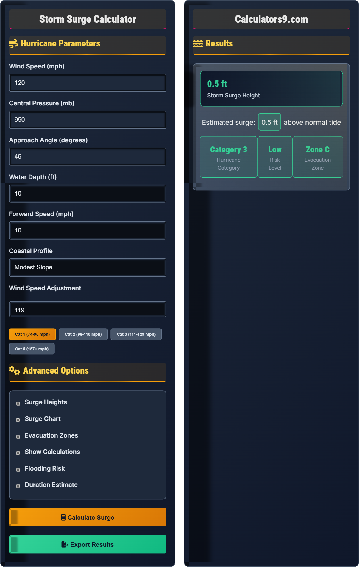
Example: For a Category 3 hurricane with 120 mph winds, 950 mb central pressure, approaching at 45° to the coast in shallow water (depth 10m):
\( S \propto 120^2 \times \sin(45°) \times \frac{1}{1013-950} \times \frac{1}{\sqrt{9.8 \times 10}} \)
\( S \propto 14400 \times 0.707 \times \frac{1}{63} \times \frac{1}{9.9} \approx 16.3 \) feet
Therefore, the estimated storm surge is approximately 16 feet.
Hurricane Parameters
Advanced Options
Results
Storm Surge Guide
Storm surge is the abnormal rise in seawater level during a storm, measured as the height of the water above the normal predicted astronomical tide. It is caused primarily by winds pushing water onshore and the low pressure of the storm "sucking" water upward. Storm surge is often the most dangerous aspect of hurricanes.
Key factors affecting storm surge:
Where V is wind speed, P₀-Pc is pressure difference, θ is approach angle, and h is water depth.
| Factor | Effect on Surge | Typical Impact | Explanation |
|---|---|---|---|
| Wind Speed | Increases | +0.5 ft per 10 mph | Surge increases with wind speed squared |
| Pressure | Decreases | -0.2 ft per mb | Lower pressure = higher surge |
| Water Depth | Decreases | Deeper = less surge | Shallow water amplifies surge |
| Approach Angle | Variable | 45° = max efficiency | Direct approach maximizes surge |
| Coastal Shape | Variable | Varying effects | Bays amplify, headlands reduce |
| Forward Speed | Increases | Slower = more surge | Slow storms build more surge |
Coastal Science
Rise in sea level above normal astronomical tide during storms.
\( S \propto V^2 \times \frac{1}{P_0 - P_c} \)
Proportional to wind speed squared and pressure inverse.
- Wind speed is most critical factor
- Shallow water amplifies surge
- Direct approach maximizes impact
Emergency Planning
Geographic areas designated for evacuation during emergencies.
\( Risk = Surge \times Vulnerability \)
Combines surge height with population vulnerability.
- Zone A: Immediate evacuation recommended
- Zone B: Voluntary evacuation recommended
- Zone C: Monitor conditions
Storm Surge Quiz
What is the primary cause of storm surge?
The answer is B) Winds pushing water onshore and low atmospheric pressure. Storm surge is primarily caused by two factors: (1) strong winds associated with the storm pushing water toward the shore, and (2) the low atmospheric pressure of the storm "sucking" water upward, creating a dome of elevated water that moves with the storm. These combined forces create the abnormal rise in sea level.
It's important to understand that storm surge is not the same as a tsunami or regular tides. Unlike tsunamis (which are caused by underwater earthquakes), or tides (which are caused by gravitational forces from the moon and sun), storm surge is specifically caused by atmospheric conditions during severe weather events. The wind component pushes water ahead of the storm, while the low pressure component raises the water level.
Storm Surge: Rise in sea level above normal astronomical tide during storms
Atmospheric Pressure: Force exerted by the weight of air in the atmosphere
Coastal Inundation: Flooding of normally dry coastal land
• Storm surge is different from tsunamis
• Low pressure contributes to surge
• Wind is the dominant factor
• Remember: Wind pushes water, low pressure lifts water
• Think of it as a "pile-up" of water
• Confusing storm surge with regular tides
• Thinking only wind causes surge (ignoring pressure)
A Category 3 hurricane with 120 mph winds and 950 mb central pressure approaches the coast at a 45° angle. If the ambient pressure is 1013 mb, calculate the relative contribution of pressure difference to the surge using the formula: Pressure Contribution = k / (P₀ - Pc), where k is a constant.
Given: P₀ = 1013 mb, Pc = 950 mb
Step 1: Calculate pressure difference: P₀ - Pc = 1013 - 950 = 63 mb
Step 2: Apply the formula: Pressure Contribution = k / (P₀ - Pc)
Step 3: Pressure Contribution = k / 63
Step 4: For comparison, if Pc = 920 mb: Pressure Contribution = k / (1013 - 920) = k / 93
Therefore, the pressure difference contributes 1/63 of the constant k to the surge height.
This calculation demonstrates how pressure difference affects storm surge. The formula shows that surge is inversely proportional to pressure difference. A lower central pressure (greater pressure difference) results in a higher surge. This is why Category 5 hurricanes with very low pressures often produce the most devastating storm surges.
Central Pressure: Lowest pressure at the center of the storm
Ambient Pressure: Normal atmospheric pressure outside the storm
Pressure Gradient: Rate of pressure change
• Lower central pressure = higher surge
• Surge inversely proportional to pressure difference
• Pressure difference amplifies wind effects
• Lower numbers = stronger storms
• Pressure difference is key factor
• Thinking higher pressure creates more surge
• Forgetting that lower pressure means stronger storm
Compare the storm surge potential of two hurricanes: Hurricane A has 100 mph winds, and Hurricane B has 150 mph winds. Assuming all other factors remain equal, how much more surge potential does Hurricane B have compared to Hurricane A? (Use the relationship that surge is proportional to wind speed squared).
Given: Surge ∝ V² (surge proportional to wind speed squared)
Step 1: Calculate surge potential for Hurricane A: S_A ∝ 100² = 10,000
Step 2: Calculate surge potential for Hurricane B: S_B ∝ 150² = 22,500
Step 3: Calculate the ratio: S_B / S_A = 22,500 / 10,000 = 2.25
Step 4: Calculate percentage increase: (2.25 - 1) × 100% = 125%
Therefore, Hurricane B has 2.25 times (or 125% more) surge potential than Hurricane A.
This problem demonstrates the quadratic relationship between wind speed and storm surge. Because surge is proportional to wind speed squared, even a moderate increase in wind speed results in a disproportionately large increase in surge potential. This is why the difference between categories of hurricanes can be so dramatic in terms of storm surge impact.
Proportional Relationship: One variable changes with respect to another
Quadratic Relationship: Variable changes with square of another
Wind Speed Squared: Wind speed multiplied by itself
• Surge ∝ Wind Speed²
• Small wind increases = large surge increases
• Quadratic relationships amplify effects
• Remember: Squaring amplifies differences
• 50% wind increase = 125% surge increase
• Thinking surge increases linearly with wind
• Forgetting the quadratic relationship
Two coastal areas are threatened by identical hurricanes (same wind speed, pressure, and approach angle). Area X has a shallow continental shelf with water depth of 5 feet, while Area Y has a steep continental slope with water depth of 50 feet. Which area would experience a higher storm surge, and why? How does the water depth affect the surge calculation?
Area X (shallow water) would experience a higher storm surge than Area Y (deep water).
The surge calculation includes a factor of 1/√h, where h is water depth. This means surge is inversely proportional to the square root of water depth.
For Area X (h = 5 ft): Surge factor = 1/√5 = 1/2.24 = 0.447
For Area Y (h = 50 ft): Surge factor = 1/√50 = 1/7.07 = 0.141
Ratio = 0.447 / 0.141 = 3.17
Therefore, Area X would experience approximately 3.2 times higher surge than Area Y.
This demonstrates why coastal geography is crucial for storm surge prediction. Shallow waters allow the storm surge to pile up more dramatically, while deeper waters distribute the same volume of water over a larger area, resulting in lower surge heights. This is why places like the Gulf Coast (shallow) often experience higher storm surges than areas with steep drop-offs.
Continental Shelf: Relatively shallow underwater area adjacent to coastline
Continental Slope: Steep underwater incline beyond the shelf
Topographic Amplification: How geography affects surge height
• Shallow water = higher surge
• Surge ∝ 1/√(water depth)
• Coastal geography matters
• Shallow bays are more vulnerable
• Deep channels reduce surge
• Consider bathymetry in planning
• Ignoring coastal geography in surge estimates
• Thinking all coastlines respond equally
Which of the following storm characteristics would result in the highest storm surge?
The answer is B) Slow-moving storm with low central pressure. This combination creates the highest storm surge because: (1) Low central pressure creates a stronger pressure gradient that "sucks" water upward, and (2) Slow forward speed allows more time for water to pile up along the coast. Fast-moving storms don't have enough time to build significant surge, while high pressure systems create less surge.
This question tests understanding of multiple factors that influence storm surge. The low central pressure is critical as it creates the maximum pressure difference driving the surge. The slow forward speed is important because it allows more time for the winds to push water onshore and for the surge to build up. Both factors work synergistically to maximize surge height.
Forward Speed: Speed at which storm moves across water
Pressure Gradient: Rate of pressure change over distance
Surge Building Time: Duration available for surge accumulation
• Low pressure = higher surge
• Slow speed = more surge buildup
• Multiple factors interact
• Low pressure + slow movement = worst case
• Consider all storm characteristics
• Focusing only on wind speed
• Forgetting the importance of forward speed
FAQ
Q: How is storm surge different from regular tides and waves?
A: Storm surge, tides, and waves are fundamentally different phenomena:
- Storm Surge: Long-term rise in water level (hours to days) caused by winds and low pressure during storms
- Tides: Regular, predictable rise and fall of water level (12-24 hour cycles) caused by gravitational forces from moon and sun
- Waves: Oscillating motion of water surface (seconds to minutes) caused by local wind action
Storm surge can raise water levels by many feet above normal tide levels, while tides follow predictable patterns and waves are surface disturbances. Storm surge is the persistent elevation of water that causes the most coastal flooding damage.
Q: How accurate are storm surge predictions?
A: Modern storm surge predictions have improved significantly with better models and data:
Accuracy:
- Within 2 feet: ~70% of the time for major hurricanes
- Within 4 feet: ~90% of the time
- Lead time: 48-72 hours before arrival
Uncertainties:
- Storm track accuracy (affects approach angle)
- Intensity changes (affects wind speed and pressure)
- Local bathymetry and topography
- Timing of landfall relative to tides
Advanced models like SLOSH (Sea, Lake, and Overland Surges from Hurricanes) incorporate detailed coastal geography and real-time storm data for more accurate predictions.